At the January 2026 quarterly meeting, neighbors learned that railroad crossings have a blue placard with an emergency phone number and the crossing’s unique identifier called the X-ing ID. OJCA surveyed the blue placards and collected the emergency numbers and X-ing IDs for each railroad crossing within our boundaries. There are two railroads -- Kansas City Southern (KCS) and New Orleans Public Belt (NOPB) -- with a total of 6 crossings within OJCA's boundaries. As lagniappe, the railroad crossing on Oak St. near Monticello Ave. is listed too since it is so close to the Jefferson/Orleans parish line.
For your easy reference, add the information below to your mobile phone, just in case you need to report a problem. It'll be safer and easier than walking up to the blue placards, which you can see in the photos below are quite small and close to the railroad tracks. Most mobile phone's contact lists have a Notes section where X-ing IDs and location details can be stored.
Railroads and X-ing IDs
1/ KCS Railway
877-527-9464
Notes:
X-ing ID: 335 620 R. Closest to Jefferson/Orleans parish line. Jefferson Highway between Lowe’s/300 Jefferson (D.O.P. Antiques, etc.) and BSC Building Specialties Co./Crescent City Industrial Services.
2/ NOPB Railroad
504-896-7442
Notes:
X-ing ID: 300-461M. Jefferson Highway between Waffle House and NOLA Motor Cars / NOLA Pickle Plex.
X-ing ID: 464-629G. Monticello Ave. at Pope St. behind Southport Hall.
X-ing ID: 464-625E. Dakin St. between Pope St. and Addison St.
X-ing ID: 464-626L. Dakin St. between Pope St. and Addison St. This railroad track is abandoned on the river side of the tracks after the railroad crossing -- the tracks stop in a wooded area.
X-ing ID: 973-409R. On the lake side of Iris Ave., which dead ends as street, towards Earhart Expressway. This is a 2-track railroad crossing.
X-ing ID: 464-630B. Oak St. between General Ogden St. and Leake Ave. in Orleans Parish.
Photos of Railroad Crossings in the OJCA Neighborhood
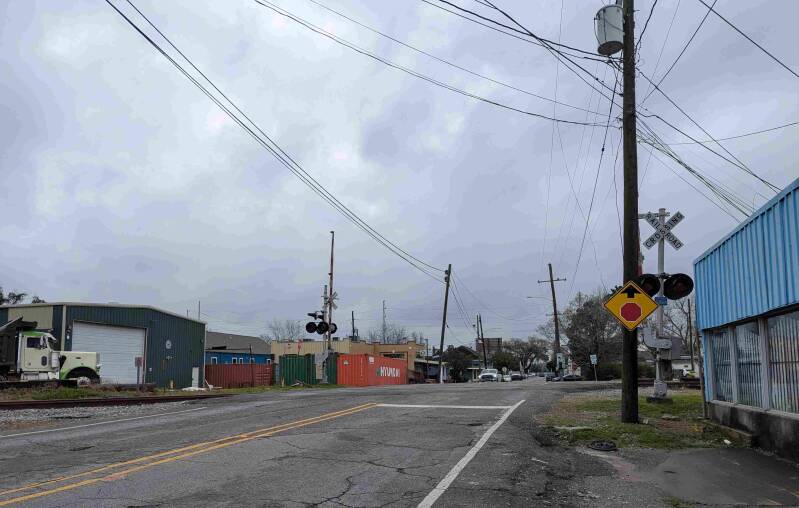
1/ KCS Railway X-ing ID: 335 620 R
Traveling towards Jefferson/Orleans parish line with 300 Jefferson Highway on the right and Lowe's on the left in the distance:
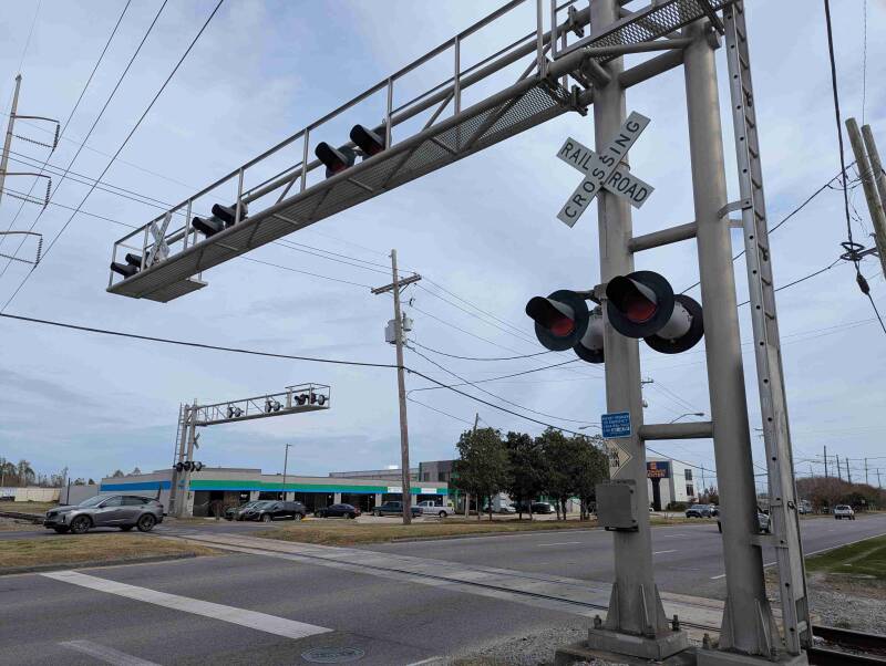
2/ NOPB Railroad X-ing ID: 300-461M
Traveling towards Jefferson/Orleans parish line on Jefferson Highway. Waffle House and NOLA Motor Cars / NOLA Pickle Plex are on the right, but are not in the photograph. The small strip mall with green and blue colors and storage facilities are on the opposite side of highway and are seen in this photo:
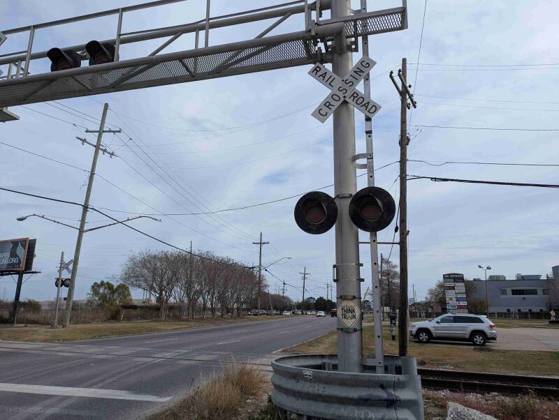
3/ NOPB Railroad X-ing ID: 464-629G
Traveling on Monticello Ave. towards the Jefferson/Orleans parish line. At Pope St. This crossing is behind Southport Hall which is the yellow/beige building on the right:
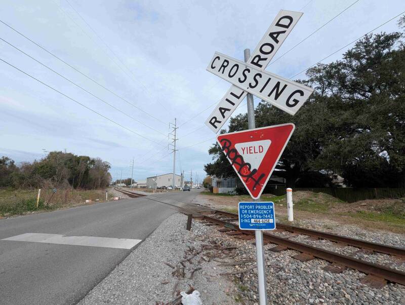
4/ NOPB Railroad X-ing ID: 464-625E
Dakin St. between Pope St. and Addison St.:
5/ NOPB Railroad X-ing ID: 464-626L
Dakin St. between Pope St and Addison St. X-ing 464-626L is closest to the photograph's bottom frame. This railroad track is abandoned after the railroad crossing. The tracks stop in a wooded area on the riverside of the tracks. Entergy's Southport Substation is to the left (partially viewable in this photo):

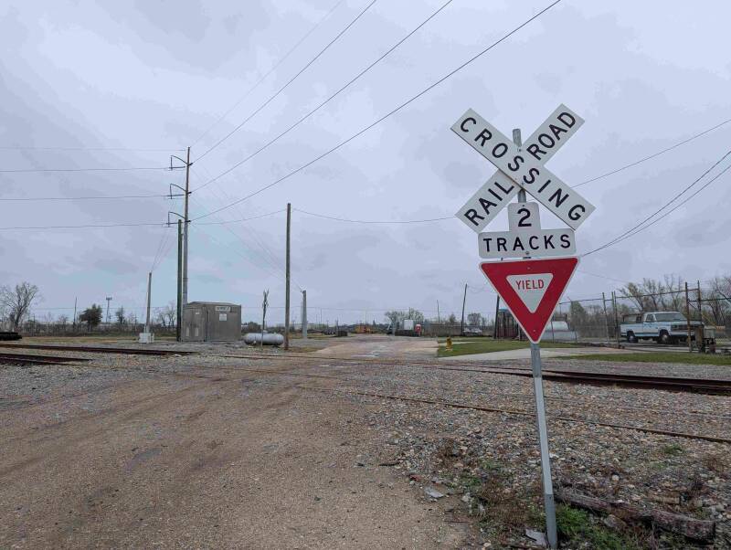
6/ NOPB Railroad X-ing ID: 973-409R
On the lake side of Iris Ave., which dead ends as a paved street, towards Earhart Expressway. This is a 2-track railroad crossing. Work trucks have been observed using this crossing. There are no residential houses past the two railroad crossings on Iris Ave:
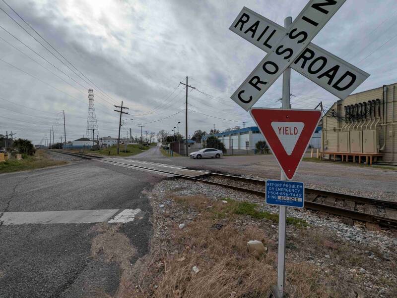
7/ NOPB Railroad X-ing ID: 464-630B
Oak St. between General Ogden St. and Leake Ave. in Orleans Parish: